Home > Europe > United Kingdom > Northern Ireland > Railways
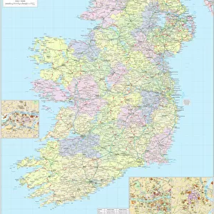
Northern Ireland Road Map

![]()
Wall Art and Photo Gifts from Map Marketing
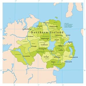
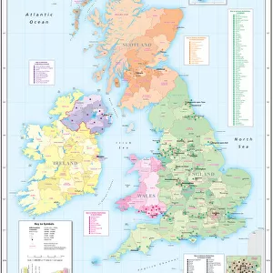
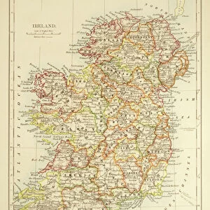
Northern Ireland Road Map
This detailed Northern Ireland road map is ideal for planning travel either for business or pleasure. Motorways, primary routes, A roads and many B roads are clearly displayed to help you identify routes. District/council boundaries and names are shown along with ferry routes and railway lines. The Irish border line is also clearly displayed, and a street level inset map of central Belfast is included
Media ID 19949697
© Map Marketing Ltd 2019, Map derived from Collins Bartholomew Digital Data Collins Bartholomew Ltd 2019
Road Map Belfast Districts Motorway Northern Ireland Ulster
FEATURES IN THESE COLLECTIONS
> Arts
> Contemporary art
> Digital artwork
> Street art
> Arts
> Photorealistic artworks
> Detailed art pieces
> Masterful detailing in art
> Europe
> Republic of Ireland
> Maps
> Europe
> United Kingdom
> Northern Ireland
> Belfast
> Europe
> United Kingdom
> Northern Ireland
> Maps
> Europe
> United Kingdom
> Northern Ireland
> Posters
> Europe
> United Kingdom
> Northern Ireland
> Railways
> Europe
> United Kingdom
> Northern Ireland
> Related Images
> Maps and Charts
> Related Images
MADE IN THE USA
Safe Shipping with 30 Day Money Back Guarantee
FREE PERSONALISATION*
We are proud to offer a range of customisation features including Personalised Captions, Color Filters and Picture Zoom Tools
SECURE PAYMENTS
We happily accept a wide range of payment options so you can pay for the things you need in the way that is most convenient for you
* Options may vary by product and licensing agreement. Zoomed Pictures can be adjusted in the Cart.